[Product] AuthaGraph Chrono Maps
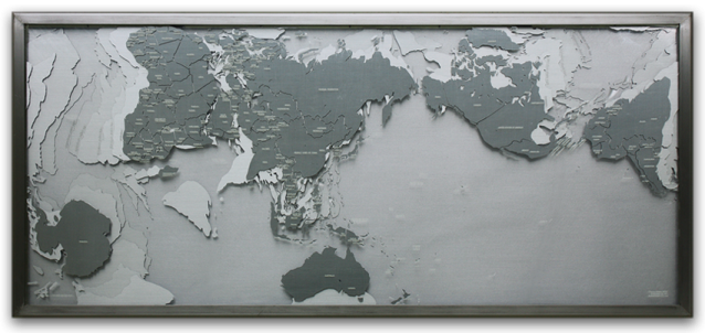
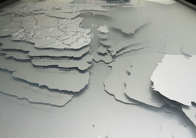
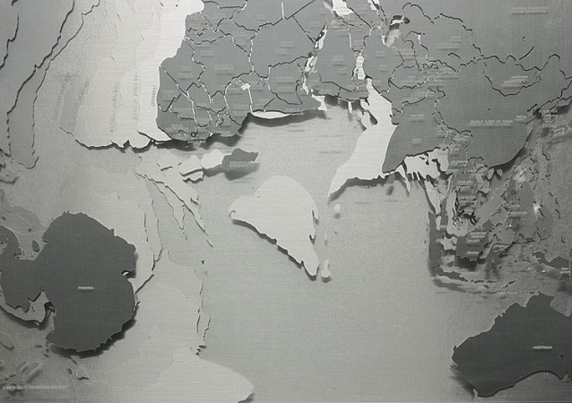
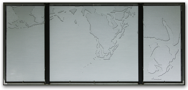
A set of AuthaGraph World Maps composed by 5 overlaying maps in different ages from 120 million years ago upto present. Their contour lines represents a coastlines in each age and then represents the plate techtoniscs’ movements.
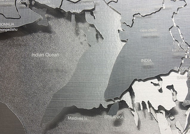
It clearly shows the Indian continent had moved across the Indian ocean separated from Madagascar and finally collided with Eurasia. It is known that the Himalayas were generated by its impact.
(size: W1354mm H614mm D74mm)
It clearly shows the Indian continent had moved across the Indian ocean separated from Madagascar and finally collided with Eurasia. It is known that the Himalayas were generated by its impact.
(size: W1354mm H614mm D74mm)
Front view
Layers of coastlines in each ages show how the coastline today was defined after a long procedure of the continental drift for 120 million years.
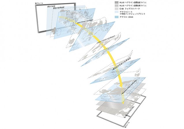
Compositions of the product of "Chrono Maps"
A metallic seat of world map in each age is fabricated by a computer added cutting machine and then sticked on a plexi grass. The product of "Chrono Maps" composes 5 plexi glasses. They are stacked and framed.
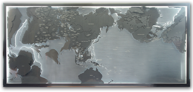
Front view with back light
A detail of its back board is design to be lit up along coastlines in 120 million years before.
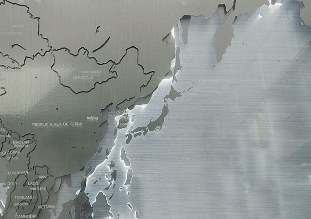
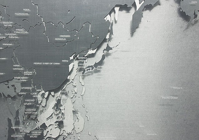
Detail image around Japan with back light
Detail image showing how coastlines overlaying
It shows how Africa and the Antarctica had been slowly torn off.
Detail of materials
A metallic seat has a direction of hairline texture. And it produces different reflection. The vertical direction of the silver seat is used for representing today's coastlines while horizontal direction is used for other four maps. That emphasizes and distinguishes the today's coastlines from other past coastlines.
Detail of materials
It is intended to represent political borders, artificial lines cracking on a solid continents. This metallic seat is used for showing the strong crack line separates a big continent into a parts.
Detail of materials
Frost glass on the metallic seat is used for representing water.
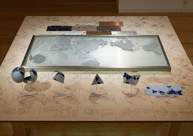
Photo in Prototype 03, an exhibition
Chrono Maps was showcased with an additional explanation by model, hand drawing and material samples.
Detail of the backside
It shows a detail of steal frames. It is able to hang on a wall by an equipment attached along two vertical frame in the middle.


