AuthaGraph Animation- Map Making Process
The animation helps understanding a 3-dimensional map-making process. You may easily understand the map is made of a combination of two projections (mapping), from a sphere to a "inflated-tetrahedron" then from the "inflated-tetrahedron" to a tetrahedron so as to reduce errors.
It shows how to cut and unfold the tetrahedron to make a rectangular map. It shows how to tile the maps as well and to frame a new world map while changing its center.
It shows how to cut and unfold the tetrahedron to make a rectangular map. It shows how to tile the maps as well and to frame a new world map while changing its center.

AUTHAGRAPH ISS LONG TERM TRACKING
A movie showing a movement of International Space Station for 12 hours recorded in October 17, 2010 (21:00-9:00 next morning.)
The movie was made by recording an original application for tracking and visualizing ISS's location in real time.
Its coordinates are provided by ‘Cerestrak’, a website distributing ISS’s orbital data. NASA and the US department of defense issue the original data.
The movie was made by recording an original application for tracking and visualizing ISS's location in real time.
Its coordinates are provided by ‘Cerestrak’, a website distributing ISS’s orbital data. NASA and the US department of defense issue the original data.
AUTHAGRAPH 600 MILLION YEAR'S HISTORY OF CONTINENTAL DRIFT
A movie showing a movement of continents for 600 million years in a format of AuthaGraph map. You can see India had moved across Indian Ocean and crushed into Eurasian Continent. The impact generated the Himalaya Mountains.
The original research on the continental drift theory is made by Dr. Ron Blackey.
The original research on the continental drift theory is made by Dr. Ron Blackey.

Tensegrity Modeling Manuals
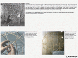
It has been difficult to understand tensegrity structure by only texts and graphics. They can not express its 3D geometry and the flow of forces. This paper regards modeling as a language instead of text and graphics. Proposed modeling manuals enable anyone over 10 years old to model it within 4 hours and experience the characters of its structure.


